Tuši

Tuši's blog

Tuesday, August 31, 2021

15447

Lithuania: Road Trip - Lithuania, Day 6: Exploring Kaunas and Rumšiškės


The Greek, Latin, German, Celtic, and the Slavic are one of the oldest languages in the World, but they are not even nearly as old as the Lithuanian tongue, which is the most ancient one from them all. It belongs to an Indo-European language group and of all the tongues spoken today, Lithuanian is the closest one to the ancient Sanskrit. The longest Lithuanian word is: "nebeprisikiškiakopūsteliaujantiesiems" which has 37 letters and the language is spoken by around 3 million native speakers.

We woke up in a rainy day and in the morning I volunteered to go shopping for breakfast. Since it didn't stop raining, everyone decided to stay at our apartment and watch TV, while I put on my rain jacket and started exploring Kaunas. Randomly I visited different places and on the way I picked up a few geocaches. I returned back with the supplies for lunch. Before the nightfall, Nada, Ana, Rok and me decided to visit the Lithuanian Open Air Folk Museum, Rumšiškės.

Previous day of our road trip to Lithuania: Day 5Day 4Day 3Day 2Day 1.

Our previous road trips: Romania 2017, Ukraine 2018Bulgaria 2019.

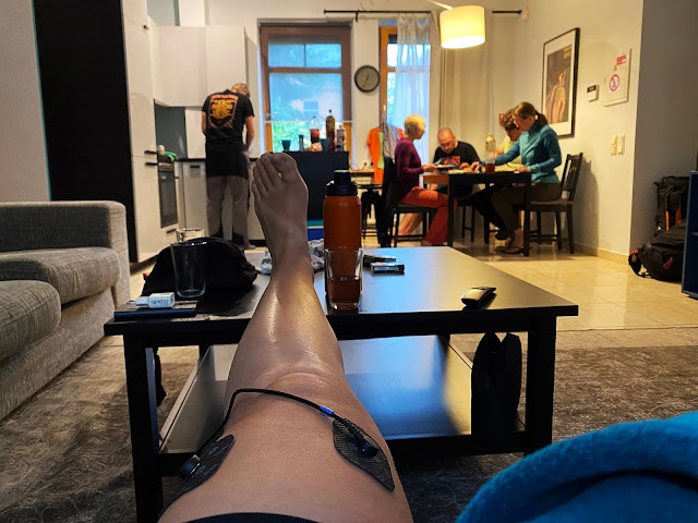
Morning activities: Nada had a therapy sessions, while Ana, Maja, Rok and Tadej had breakfast made by Tuši.

Walk along the Neman river, that rises in central Belarus and flows through Lithuania. After 937 kilometres it drains into the Curonian Lagoon.

Behind the Kaunas State Drama Theatre.

Laisvės alėja - Liberty Avenue is with 1.6 kilometres the longest pedestrian street in Eastern Europe.

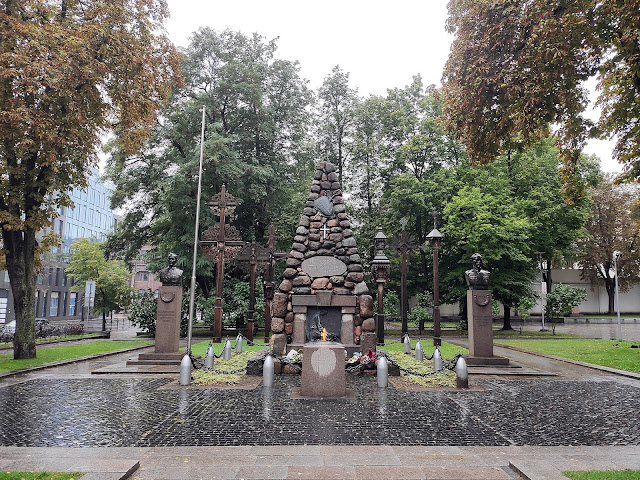
Žuvusiems už Lietuvos laisvę paminklas - Monument to Those Perished for the Freedom of Lithuania was created by the sculptor Juozas Zikaras and the architect Vladimiras Dubeneckis and was unveiled on 16. October 1921, later demolished in 1949 and reconstructed in 1990.

Vytauto Didžiojo karo muziejus - Vytautas the Great War Museum.

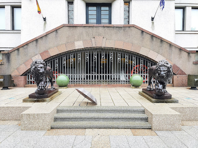
One of the most famous objects in front of the Vytautas the Great War Museum are the lions, who came to Kaunas from the Astravas Manor and who guard the entrance to the museum. They were commissioned by Count Jonas Tiškevičius and cast from cast-iron in St. Petersburg in the middle of the 19th century. After the construction of the new Vytautas the Great War Museum building, Jonas Tiškevičius, the son of Count Tiškevičius, donated the lions to the Museum.

Our girls from the van in the future?

 
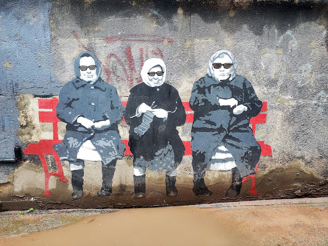
Courtyard Gallery is established next to the Kaunas Synagogue, among houses, which during the Inter-war period were mostly inhabited by Jewish families.

 
Kaunas city wall and the stairs to the Pelėdų kalnas - Owl hill.

 
Pelėdų kalnas - Owl hill got its name in 1924, when the fence surrounding a 3.5-hectare area was decorated with a grand total of 108 owls. The sculptures were created by Vincas Grybas (1890–1941), a student at Kaunas art school located on the very same hill.
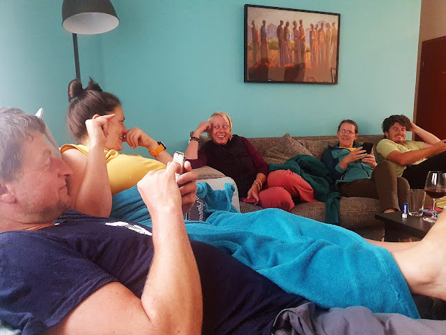
Mood after lunch.

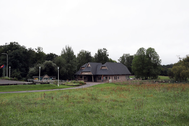
The rain finally stopped and with Ana, Nada and Rok we visited Rumšiškės, a town best known for its excellent open-air ethnographic museum.

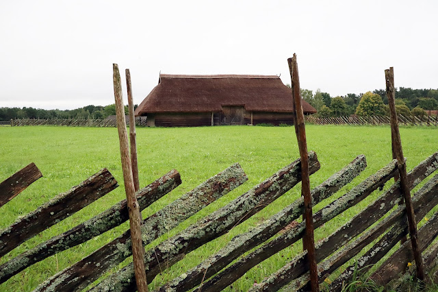
The Open-Air Museum of Lithuania is one of the largest ethnographic open-air museums in Europe that stretches across the area of 195 ha.

 
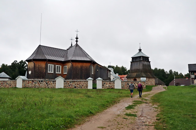
The centrepiece of the museum is a town featuring buildings from all over Lithuania typical to different time periods.

 
The town has all prerequisite town elements: a market square with natural stone paving, a church, an inn and houses of various craftsmen and traders engaging in pottery, weaving, amber and wood crafting.

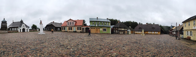
We were the last visitors, so the town square was empty.


The total area of 175 ha contains 140 buildings from the 18th-19th century with the restored original interiors and surroundings. This museum was established to help to preserve and research the former ways of living.

Each year the museum holds more than 15 events (Mardi Gras, Easter, Stork Day, Crafting, Work and Amusement Day, St. John’s Eve, St. Anne’s and Rye Harvest Day, Assumption of the Virgin Mary Day, Stump Burning on Christmas Eve, etc.).

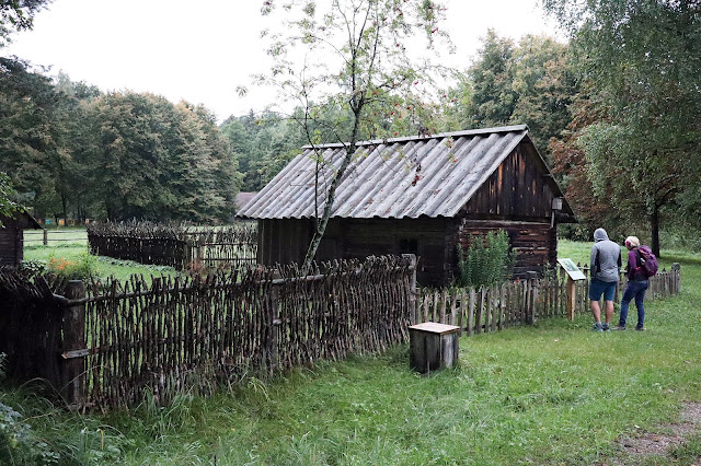
The buildings of this museum are exposed as farmsteads and all of them together represent the main ethnographic regions of Lithuania: Aukštaitija, Samogitia, Dzūkija and Suvalkija. Each has the homes, barns, granaries, stables, mills characteristic to the area.

 
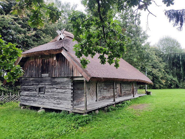
Inspecting the thatched roof house.

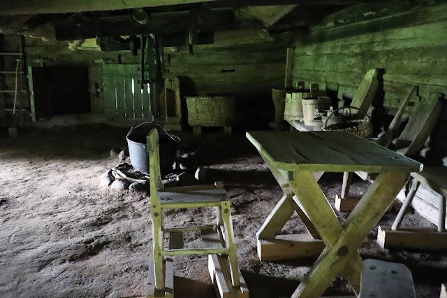
Interior of one of the houses.

The area is quite huge, so that around 10 km of walking is required to see everything.

Windmill.

 
Caught doing another selfie.

 
Engineers checking the shake roof.

 
Another windmill.

Buying a new property?

 
Towards the houses from Dzūkija, one of five ethnographic regions of Lithuania.

 
Nobody home, so we moved on towards the exit.


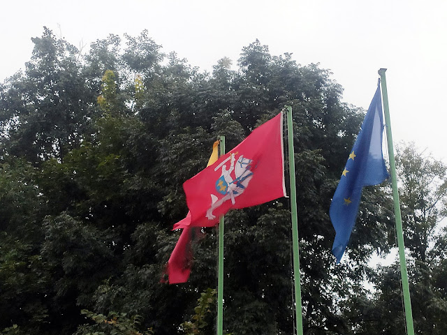
The state flag of Lithuania displays the national emblem in a banner form, flag was adopted in 2004.

Road Trip - Lithuania, Day 6.

Geocaches found (all received a visit by trackable item "Filmmusik", TB7370F):
- Kaunas Cultural Centre, GC3XKDB
- Pedestrian bridge, GC8TMDM
- "Lietuvos teatrui 100", GC9E3HY
- Donut - a constant, Virtual, GC7B9RD
- Vytautas the Great War Museum, Virtual, GC7B94W
- A. Žmuidzinavičiaus kūrinių ir rinkinių muziejus, GC6JZT6
- Kiemo galerija. Virtual Reward 2.0, Virtual, GC891C9
- Malūnininko bokštas, GC8VNH2
- Pelėdų kalnas, GC7GD4X


Monday, August 30, 2021

15446

Lithuania: Road Trip - Lithuania, Day 5: From Vilnius over the Highest Mountain to Kaunas


According to a study made by a French scientist Jean-George Affholder in 1989, Lithuania is positioned in a geographical center of Europe. Jean-George re-estimated the boundaries of the continental Europe and he determined that the geographic center is located at 54°54′N 25°19′E, near a Lithuanian village named Purnuškės. The method that he used for calculating this point was based on the center of gravity of the geometrical figure of Europe.

Once more I woke up a little earlier than others and I did a morning walk through the Vilnius. After the breakfast we were on the road again. First we hiked to two highest mountains in Lithuania, Aukštojas Hill and Juozapinė Hill. Soon we explored the area around the Dubingiai Castle following the lunch in a village Labanoras. The Lithuanian Museum of Ancient Beekeeping was unfortunately closed, so we just quickly sneaked inside and made a few photos. Gravel roads led us out of the regional park to the treetop adventure in Anyksciai. After the walk above the trees and next to the nearby Šventoji river we parked our van in Kaunas.

Previous day of our road trip to Lithuania: Day 4Day 3Day 2Day 1.

Our previous road trips: Romania 2017, Ukraine 2018Bulgaria 2019.


St. Anne's Church (Šv. Onos bažnyčia) was established established between circa 1495–1500, while The Cathedral of the Theotokos (Vilniaus Dievo Motinos Ėmimo į Dangų katedra) was built during the reign of the Grand Duke of Lithuania Algirdas for his Orthodox second wife Uliana of Tver in 1346.

 
Leaving the narrow garage.

Strategic decisions, how to conquer the highest point of Lithuania.

 
And we made it with the special gear, helmet, drill and an angle grinder. Without them, the summit of Aukštojas Hill would remain unconquered.

Aukštojas Hill is the highest point in all of Lithuania. It is located in the Medininkai Highlands.

About 10000-15000 years ago, the entire territory of the country was covered by a glacier. Various moraine sediments accumulated around its edges including boulders, gravel, sand and pebble. Powerful glacier waters polished the surface of the Medininkai Highlands making it fairly flat and clear of any hills or gullies. This is why the view that opens up from the observation tower located at the top of the 300-metre high Aukštojas Hill still leaves you wondering whether you are really looking at the landscape from the highest point in Lithuania.

The Balts' Sun Circle symbolises an ancient altar. Its centre contains an image of a crown that is, it seems, elevated above Lithuania. The crown is surrounded by the granite heads of four horses. The Žemaitukas breed of horses look at different sides of the world, protect the crown and spread the news about Lithuania to all corners of the globe.

View to the tower and 293.84 m high Aukštojas Hill.

Expedition members: Tuši, Nada, Rok, Ana, Tadej and Maja.

Our 7th member did come nice aerial photos.

Aukštojas in Baltic Mythology: Aukštojas is the name of the chief deity of the Balts mentioned in written sources from the 14thcentury as the supreme heavenly deity, the creator of the world and the protector of the principles of morality and justice. The supreme God is the first, eternal and has no beginning. Ancient Lithuanians gave him different names such as Praamžius, Sutvaras, Vaisgamtis, Labdarys, Gyveleidis, Ūkopirmas among others. Aukštojas existed before the creation of the world, when darkness still prevailed. He was believed to take on the image of a pigeon and fly around the world dividing it into parts. He scattered the darkness with light and opened up a path. While walking on it he spat to his left side and saw a human-like creature appear from the water. God commanded the creature to dive into the water and bring him the seeds of the earth. On the third dive the man came back, his mouth and ears filled with seeds. Aukštojas scolded him for being so greedy, sowed the seeds and soon saw growth on the land.

Maybe we should name him Aukštojas?

Farm near the summit.

 
Since the 3rd highest hill was nearby, we didn't want to miss it. Rok quickly took an opportunity and he made a photo with King Mindaugas.

 
Geocaching on high altitudes.

Juozapinė Hill used to be regarded as the highest point in Lithuania. Its elevation is 292.7 metres and is now the third highest summit after the nearby Aukštojas Hill (293.84 m) and Kruopinė (Žybartonys) Hill (293.65 m), situated approximately 10 km west of Juozapinė Hill.

 
After some driving we stopped by the Lake Asveja and then we climbed to the Dubingiai Castle Hill.

 
We did a walk on the cognitive trail on the former island, now a peninsula. There is not much left from the Dubingiai Castle, only the foundations.

The first masonry castle was constructed by Vytautas, Grand Duke of Lithuania, in 1412-1413 in order to secure the capital Vilnius from attacks from Livonia.

Dubingiai Castle was the main seat of the Biržai-Dubingiai line of the Radziwiłł family until the second half of the 17th century, when it was transferred to Biržai Castle.

During the Polish-Swedish wars, the castle was pillaged by armies loyal to the King of Poland and was confiscated from Bogusław Radziwiłł. It returned to the family in the second half of the 17th century. The neglected castle and church gradually fell into ruins. It was sold to Michał Tyszkiewicz in 1808. Today only the foundations and several cellars of the castle and church remain and are being researched.

 
Getting ready for the picture with the drone.

Dubingiai bridge, located along Lake Asveja, is one of the few wooden bridges that remain in Lithuania. Before the bridge was erected by the President of Lithuania Antanas Smetona in 1934, a ferry and a ferryman's house, built by Count Tiškevičius, were erected along the lake. On the bottom of the lake, the piers of the bridge show that the bridge already existed in the Middle Ages.

Lake Asveja is the longest lake in Lithuania (length: 21.9 km or 29.7 km counting the Žalktynė, Vyriogala and Dubingiai bights). It covers 9.78 km2 area and reaches a depth of 50.2 m which makes it the third deepest lake in the country. 

 
After some more driving we stopped in a small town Labanoras, where we had lunch. The village is surrounded by the Labanoras Regional Park, the largest regional park in Lithuania.

Almost 500 years ago, in 1522, Labanoras Church was mentioned for the first time. In 1675, the bishop's protocol mentioned the already old, collapsing church of Labanoras, and referenced its miraculous painting of Mary on the wall. It burned down in 1798 and 2009 and after 2011 it is fully restored again.

 
After the short walk around the church we moved on.

 
Driving through the countryside to the Lithuanian Museum of Ancient Beekeeping.

 
The beekeeping in Lithuania started to thrive from the 16th century and began with the beekeeping in the natural tree hollows. Later on, the beginning of the 20th century brought innovation, and people started using beehives.

The museum, part of Aukštaitija National Park, was founded by the beekeeper Bronius Kazlas.

As of 2006, the museum consisted of six buildings, about 500 displays, and 25 sculptures. In addition to illustrating the history of beekeeping in Lithuania, some of the museum's wooden sculptures themselves contain beehives. The sculptures pay homage to the honeybee's place in worldwide mythology and folklore, including Egyptian and Native American figures as well as the Lithuanian god Babilas and goddess Austėja. They were carved by Teofilis Patiejūnas and Ipolitas Užkurnis.

 
Hard life.

 
The museum was closes and since we sneaked in, we couldn't stay long.

The Beekeeping Museum is located in the north-western part of Aukštaitija National Park, on the edge of the Thought Forest, in the oldest village of the park, Stripeikiai, which was first mentioned in the Livonian Chronicles in 1357. 

Interesting oak sculptures.

Our van got the name - Dizlca.

Through the Aukštaitija National Park, established in 1974 and thus the oldest one in Lithuania.

More than 70 percent of park's area is covered by woods. 80 percent of woods are pine stands, some reaching 200 years old.

Good gravel roads were percfet for rental car.

Our last stop was the second-largest boulder in Lithuania, Puntukas. It measures 6.9 metres in length, 6.7 m in width, and 5.7 m in depth (including 1.5 m underground). It weighs about 265 tons and is made of Rapakivi granite. In 1943, sculptor Bronius Pundzius engraved portraits and quotes from last wills of Lithuanian pilots Steponas Darius and Stasys Girėnas for the 10th anniversary of their deaths during the transatlantic flight with Lituanica.

Passing the boulder we entered the treetop walkway.

 
Anyksciai Treetop Walking Path is a short, but enjoyable 300-meter walk above the trees, ending with a panoramic views of the forest.

The Treetop Walking Path is 300 meters long and gradually rises to 21 meters above the ground.

 
We were here.

 
The watchtower at the end of the path is 34 meters high and enables visitors to observe the praised Anykščiai Pinewood, admire the winding Šventoji River, and see the towers of St. Matthew Church, which is the tallest church in Lithuania.

 
395 tons of metal and 1500 cubic meters of concrete were used to build the trail.

Nada on her way to the top of the 34 meters high observation desk.

We extended our hike over the Šventoji river, the longest river that flows entirely within Lithuania.

Net time we will come with the kayaks.

Finally time to rest in Kaunas.

Road Trip - Lithuania, Day 5.

Geocaches found (all received a visit by trackable item "Filmmusik", TB7370F):
- 100 Lietuvos iškiliausių - Albertas Goštautas(2), GC65HCA
- Gediminas dream, Virtual, GC8920T
- Uzupio Angelas my crow, GC11B6C
- Aukštojas, GC6KHCD
- 100 Lietuvos iškiliausių - Mindaugas, GC5Y69F
- Dubingiu piliaviete, GC2HMN5
- Radvilų Tėvonija, Virtual, GC88Z43