Tuši

Tuši's blog

Sunday, July 30, 2023

16145

Slovenia: Orlova Pot / Eagle's Path on Dolga Njiva


Eagle Trail is a pleasant and relatively effortless way to learn about many interesting features of the local landscape. The loop trail is easy and suitable for families who are less interested in an adrenaline rush and more interested in satisfying their curiosity about natural history and sampling tasty local foods.

WW2 memories. Allied troops were sending help from the air in containers like this.

The Dolga Njiva mountain pasture offers authentic herders fare, rest and relaxation.

 
Start of the Eagle Trail.

 
Learning new things and sometimes remembering old ones.
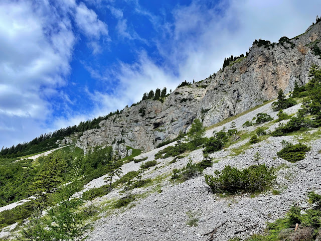
Have you ever watched a majestic bird soaring from time to time above the Košuta massif? The golden eagle, an endangered species, nests on these steep slopes above the mountain pasture of Dolga Njiva, at home in the kingdom between the rocky grey cliffs and the open blue sky.

 
We didn't find any hunters inside.

  
Getting stoned with formic acid - CH2O2.
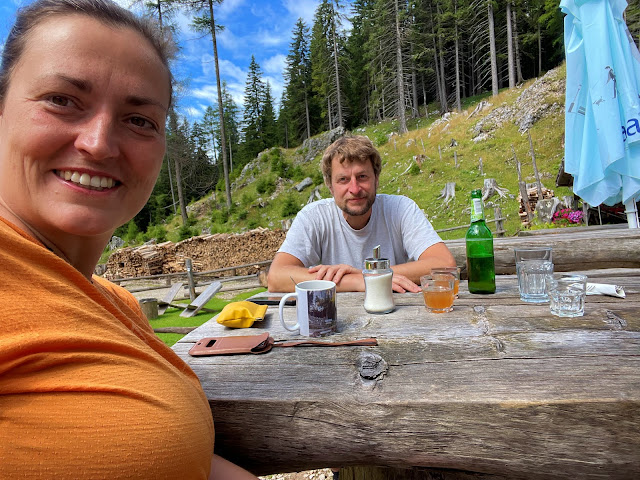
Back at the hut.

 
After the delicious mini lunch we returned back home - Garmin Connect.

Geocache found:
- Zlomljena krila - Spuščališče pod Košuto, Multi, GC9G4T8, that received a visit by trackable items "MissJenn’s 5 Cents", TB9K7R9 and "Sukerbiet 1", TB9VDJJ


Saturday, July 29, 2023

16144

Slovenia: Baba


Sara and Nada's brother Jure visited us and we decided to go hiking. Our plan was to visit mountain pasture Korošica, but since we all felt very olympic, we extended our trip to Košutica, also known as Baba in our area. Bronco was with us all the time, accouraging us not to give up. We finished the hiking (Garmin Connect) day back home with the slow barbecue.

We started the hike through the nice shady forest.

Arrived to mountain pasture Korošica.

Bronco, Jure and me had a men conversation on the way up, so we left Sara and Nada behind us. From the top we had a beautiful view to the pasture and the Karawanks on the West.

Bronco was happy to see Sara and Nada again.

Resting mode.

Model Bronco.

Signing into the book.

Still resting.

 
We were not in a hurry.

View to the Košuta ridge.

Nada, Jure, Sara, Tuši and Bronco on top of Košutica, 1968 m.

The return.

Back on the pasture.

Cows with Veliki vrh, 2088 m.

Home made "snacks" on the mountain pasture.

Back to the valley.

 
We were ready for the slow food from the barbecue.

Geocache found:
- Košutica ali Ljubeljska Baba, GC9W531, that received a visit by trackable items "MissJenn’s 5 Cents", TB9K7R9 and "Sukerbiet 1", TB9VDJJ and where I dropped off "Schwarzer Delfin mit Anker", TB9YMGV


Friday, July 28, 2023

16143

Slovenia: Morning hike to Prelaz Ljubelj


It's Friday again and Nada and me were working from home, so we used first hours before that for our hike to nearby Prelaz Ljubelj. As usual, Bronco joined us and we all had a great start of the day - Garmin Connect.

Start of the beautiful day.

Nada, Tuši and Bronco.


Thursday, July 27, 2023

16142

Slovenia: Via Ferratas Pot Mojstraniških Veveric and Jerm'n


After work I picked up my nephews Matic and Tim and together we drove to Mojstrana where we decided to climb one of the easiest via ferratas in the area, called Pot Mojstraniških veveric (Mojstrana Squirrels). The route named after the top climbers from the area is graded C/D and took us to the top of Grančišče. After the descend we drove to Gozd Martuljek and it was time to climb the 2nd via ferrata. Jerm'n is 220 m long and overcomes an altitude difference of 180 m, and is rated with a D / E difficulty rating. Since Tim and Matic are strong, we didn't have any issues and we successfully fulfilled our today's planns.

All geared up, ready to climg.

 
Almost vertical first part.

 
Over the ladder.

View to Mojstrana, Dovje and Karawanks.

Approaching the end of our first via ferrata.

 
And we made it, Pot Mojstraniških veveric, B/C - Garmin Connect.

 
Steep start of the via ferrata Jerm'n, graded D.

Over the creek.

 
The steepest part.

  
In the shade above the waterfall.

 
Once more over the creek and straight up, where we finished our climbing.

View to Julian Alps.

 
And we are done, Jerm'n was conquered - Garmin Connect. The route led us along this nice waterfall. If you look sharply, you can see the tools in the rock.

Geocache found:
- Jerm'n, GC8KCNM, that received a visit by trackable items "MissJenn’s 5 Cents", TB9K7R9, "Sukerbiet 1", TB9VDJJ and "Schwarzer Delfin mit Anker", TB9YMGV