Tuši

Tuši's blog

Monday, June 27, 2022

15747

Switzerland / Italy: Nadelhorn


We woke up at 3 a.m. and after the breakfast we left the Mischabelhütte a little before 4 a.m., direction 
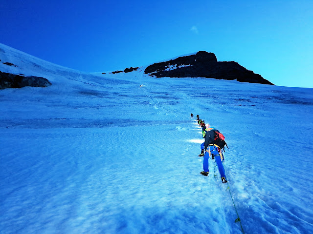
Nadelhorn. I soon realised, that I forgot the headlamp, but I managed without it. After a while we put on our crampons and formed the rope teams and we slowly advanced over the glacier towards the saddle between our mountain and Ulrichshorn. From the saddle we simply followed the ridge all the way to the summit of Nadelhorn, 4327 m. We took a few photos on the top and then we returned back to Mischabelhütte on the same way. It didn't take long that we all regrouped, we took a group photo and returned back to Saas-Fee, where the bus picked us up and drove us back home. Another successful glacier course was behind us.

Previous days of our glacier travel and crevasse rescue course: Day1 - 15745, Day 2 - 15746.
Previous courses: 2021 (Day 1 - 15380, Day 2 - 15381), 2016 (Day 1 - 13553, Day 2 - 13554), 2015 (Day 1 - 13189, Day 2 - 13190).

Getting ready at 3:40 a.m.

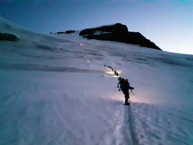
With the help of the headlamps over the glacier.

Hohbalmgletscher - Hohbalm Glacier lies nestled between the Lenzspitze, Nadelhorn and Ulrichshorn.

Still waiting for the sun.

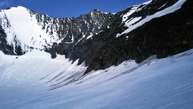
The edge of the glacier below Lenzspitze and Nadelhorn.

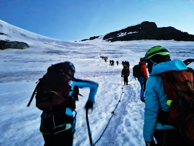
Yes, the whole bus was here.

 
On the saddle called Windjoch, 3847 m.

 
Following the ridge.

 
Lower amounts of oxygen were affecting us.

 
Some segments were a mixture of snow and rocky surface.

Anže dropped his ice-axe, so he decided to pick it up. He returned with 3 of them.

Our team reached the summit of Nadelhorn, 4327 m.

 
Our rope team: Janez, Aljaž, Nina and me.

 
We carefully descended back towards the saddle.

Back at the Mischabelhütte - Mischabel Hut.

 
AO Tržič and Chera Hiking.
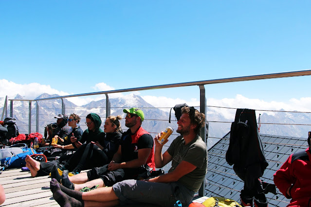
Tired and happy.

One for the road.

Back to Sass-Fee.

Below the cross.

 
Local gang.

After the tour - Garmin Connect, we found normal beer prices in a market.

Time to go back home.


Sunday, June 26, 2022

15746

Switzerland: Hike to Mischabelhütte


In the morning we left our campsite and we were all relived, that the owner didn't come with us. The bus took us once more to Sass-Fee, from where we started hiking to Mischabelhütte with all our winter gear. Some were very quick, while some of us decided to take it easy, so we arrived to the hut a little after 2 p.m. After we settled in, we had plenty of time for playing cards, we had a few beers and a great dinner. Before we went to bed, we set our alarm clocks to 3 a.m. in the morning.

Previous day of our glacier travel and crevasse rescue course: 15745.
Previous courses: 2021 (Day 1 - 15380, Day 2 - 15381), 2016 (Day 1 - 13553, Day 2 - 13554), 2015 (Day 1 - 13189, Day 2 - 13190).

 
Leaving the campsite.

Through Sass-Fee.

Fully loaded.

Looking back to the main village in the Saastal, or the Saas Valley.

Jernej consuming his energy drink on the way up.

View to our yesterday's peak, Allalinhorn, 4027 m.

Life is a winding road.

Over the rocks we reached the cross.

Quick geocache and then just a few more steps to the hut - Garmin Connect.

Time for a break.

 
No comment necessary.

Our boss had a reservation on his name.

Playing a serious game, a rummy.

Geocaches found (all received a visit by trackable items "Chakkuri's Community Volunteer Travel Tag", TB676DY, "Get a photo of a tree", TB8JV00 and "Magic: The Gathering, Rivals of Ixalan Trackable: Vampire Die Bonbon Dose", TB8Q8AY):
- Am Weg, GC683TV
- Der Zeitzeuge, GC6PHK4
- Schöneck, GC8XAWC
- Mischabel, 3'340m, GC90D96


Saturday, June 25, 2022

15745

Italy / Switzerland: Flying from Allalinhorn


Our alpine section AO Tržič finally arrived to our designated campsite and immediately we pissed off the owner of the camp. The owner wasn't there in the morning, so we simply settled ourselves on the only possible place in the camp and from that time on, she monitored our every step. Charging the phones in washroom wasn't allowed, cooling the beers in nearby creek either, not to mention that even looking at her almost costed someone 5 swiss francs. Soon everyone found out, that the best way is to simply avoid and ignore her and life was quickly simpler.

After we settled in, the bus took us to Saas-Fee, where we bought the tickets for the cable car and the Metro Alpin, the highest funicular in the world, to Mittelallalin. From there we started hiking towards the top of our today's summit, Allalinhorn. Half way up, we formed the rope teams, since we had to walk over the glacier. Summit was easily conquered and one more four-thousander was in my pocket. While others started walking back down, Jernej, Anže and me spread our wings and flew back to the Sass-Fee, where we waited for the with a cold beer in our hands. After we regrouped, the bus took us back to our beautiful campsite, but since we had a few beers in us, the life was easier with the owner of the camp. Well, maybe not for her.

Transporting the gear over the Saaser Vispa to our campsite.

If you ignore the STOP sign, life can get complicated.

Hiking through Sass-Fee and some typical traditional raccard granaries.

Anže pointed out, what is our goal.

View from the village.

The cable car took us to Felskinn.

The Metro Alpin is an underground funicular situated above the Swiss town of Saas Fee, in the canton of Valais. Opened in 1984, it links the Felskinn cable-car station (2980 metres) on the shore of the Fee Glacier to the Mittelallalin (3456 metres) in the north flank of the Allalinhorn. The Felskinn–Mittelallalin Tunnel has a length of 1749 metres, with an altitude difference of 476 metres between the two stations. The Metro Alpin is the highest funicular in the world. Being a fully underground railway, it is also considered the highest subway in the world.

Our goal, Allalinhorn, 4027 m.

Start of the hike.

Forming the rope teams.

White & blue.

Glacier crevasse. That's why you need to be attached to a rope team.

Walking over the Feegletscher - Fee Glacier.

While we were approaching the top, one paraglider was already in the sky.

Matterhorn showed up on the saddle.

The first ascent of the Matterhorn was in 1865 from Zermatt by a party led by Edward Whymper, but during the descent, a sudden fall claimed the lives of four of the seven climbers.

Nada and me were below the Matterhorn in 2019 - 14648.

 
And we reached the summit of Allalinhorn.

After I found a geocache on the top, Anže, Jernej and me prepared our wings.

Nice and calm day for flying.

Jernej during the take off.

Great job Jernej.

Flying towards the valley.

And finally it was my turn.

 
With Matterhorn face to face.

One last view to the amazing pyramid.

Me flying towards the valley.

View to Alphubel, 4206 m.

Chasing Jernej.

 
Through the cloud.

 
Since it was quite calm in the air, I was able to get a few more photos.

Above the Fee Glacier and Sass-Fee.

One last view to the Allalinhorn and then it started to become windy, so we needed to prepare for safe landing - Garmin Connect.

Happiness at the end of the hike & fly adventure.

Meeting the others in the village.

 
Ending the day back in the campsite.

Geocache found:
- Allalinhorn, 4027m, GC73GD2, that received a visit by trackable items "Chakkuri's Community Volunteer Travel Tag", TB676DY, "Get a photo of a tree", TB8JV00 and "Magic: The Gathering, Rivals of Ixalan Trackable: Vampire Die Bonbon Dose", TB8Q8AY